Tag Archives: Alouette Lake

Mt Nutt, 20 Aug 2016

Bob H. on Mt Nutt:
“Mount Nutt is in Golden Ears Provincial Park and the trail was made between 2011 and 2013 by the Ridge Meadows Outdoor Club. The first 1.6 km from the parking lot is a very gentle slope on a gravel path (East Canyon Trail), which is a good warm up. At the 1.6 km mark, you take a right turn into the forest and the vertical gain really starts – suddenly you find yourself heading up fast. The trail is very well marked (can be slippery when wet). For a while, the climb follows a small creek, which drains a small lake further up.

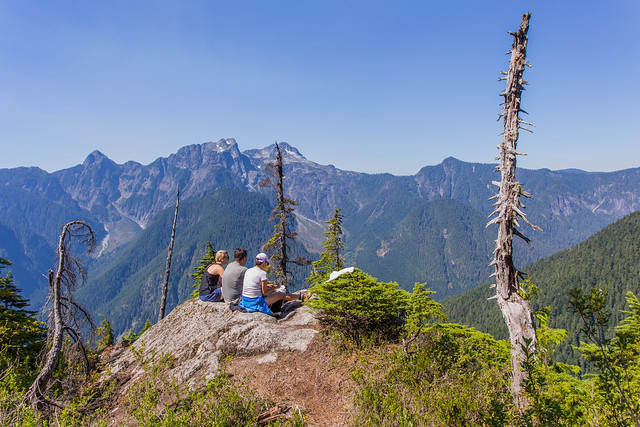
The lake is nice and the area around it gives you a little reprieve from the gruelling climb. Soon after leaving the lake area, the climb continues. Eventually, we reached a viewpoint (680 m), which offered a pretty good view of Alouette Lake.

Continuing along the ridge, you are treated with about 4 more viewpoints overlooking Golden Ears, Evans Valley, Edge Peak and Alouette Lake, among others.

Photo album of hike is here

My blog, with trailhead/parking location and route stats, is here.”

Group at viewpoint

Alouette-Stave Trail, 7 Nov 2015

Chris N. on the Alouette-Stave trail:
“Last Saturday was one of the most thoroughly rainy hiking days I have experienced. It was with trepidation that we drove up the Florence FSR towards the trailhead. It’s 2wd the whole way but it does get rougher after the 11 km mark and traction could be an issue on the rocky uphills. Watch your odometer carefully since it can be tricky finding the right turn-off – it’s around 19.6 km on the left. About 200 m in, there are 2 locked gates but lots of parking. We walked down the road to the last switchback where there’s a lot of flagging tape marking the well-trodden track of the Robie Reid trail. Multiple streams poured down from the slopes above and the trail was a creek in places. There were some overhanging branches in places but not a lot of blowdown. The major creeks were almost topping the bridges. We found the cabin after a brief bushwhack but never did find the junction with the Alouette-Stave Lake trail (bivouac.com mentions that the intersection is at 49.39176, -122.32243 but I didn’t have that waypoint with me). We went as far as the Alouette River (which was raging!) before calling it a day.”