Andy G. on Brandywine Mountain:
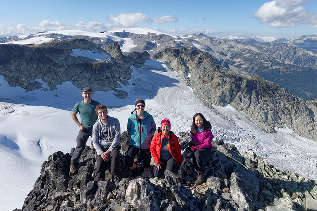
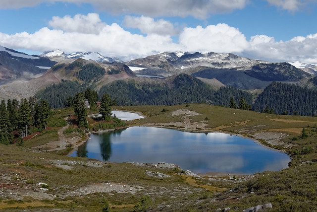
“Brandywine has quickly become one of my favourite summits. It’s a great mix of easy hiking and more challenging boulder-hopping with some steep terrain and a bit of route-finding thrown in for good measure. And then there are the stunning views. Mountains, glaciers, meadows, lakes… Definitely a hike to save for a sunny day.
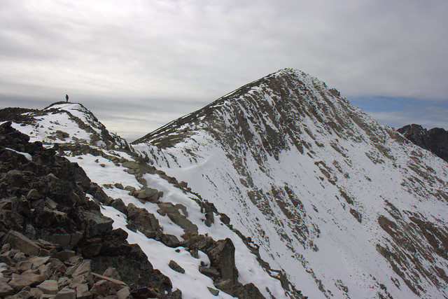
The new trail into the meadows still has a muddy spot or two but it’s a massive improvement on the old trail. We were in the upper meadows within an hour or so. Beyond that there is an intermittent trail and cairns for guidance up to the ridge. More cairns point the way up to the higher part of the ridge, although they run out a couple of hundred metres short of the summit, which is where the route-finding comes it as the summit can’t be seen at this point. The summit itself is a small bump on top of a bigger bump, big enough for our group to find (un)comfy rocks to sit on to enjoy lunch.
The road to the upper parking lot is very rough and steep in places: our CR-V struggled in a couple of spots with a full load of 5 hikers. A vehicle with some clearance is a good idea as the bumpy road causes the vehicle to bounce quite a bit. A Subaru Outback made it up OK though. Budget about half an hour for the logging road.
Car-to-car was almost exactly 8 hours (we were leaving the meadows just as the sun set). We finished the day with a quick bite at the Howe Sound Brew Pub before heading home. Thanks to Sarah, Simon, Anna, and Janavie for joining me and making it such a great day out.”